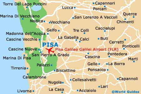
Pisa Galileo Galilei International Airport (PSA)
Orientation and Maps
(Pisa, Italy)
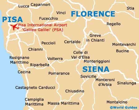
One of Italy's most famous and treasured cities, Pisa is located in the Tuscany area, close to coastline. Lucca is located around 17 km / 11 miles to the north-east of Pisa, with the Mediterranean Sea just minutes to the west.
Pisa has gained much of its notoriety and fame from its stunning Leaning Tower, known locally as the Torre Pendente. The Leaning Tower of Pisa is the bell tower to the cathedral (Cattedrale - Il Duomo di Pisa) and throughout the year attracts thousands of visitors each week.
Many visitors to Pisa fly into the city via the Galileo Galilei Airport (PSA), which is located just minutes to the south of the city. Pisa also boasts a fairly comprehensive public transport network, with regular trains and buses travelling to nearby locations, which include Florence, Prato and also Pistoia. Trains arrive and depart from the Piazza Vittorio Emanuele II and at the Piazza San Antonio.
Pisa Galileo Galilei Airport (PSA) Maps: Important City Districts
The city of Pisa was first laid out during the middle of the 11th century and is centred around the Field of Miracles (Campo dei Miracoli), where the cathedral, bell tower and baptistery reside, surrounded by a large expanse of grass.
Pisa's remaining city centre is easy to walk around and features narrow alleyways with a true medieval character. On the south-eastern side of the city, the Museo Nazionale di San Matteo lies alongside the River Arno and is home to an exceptional collection of religious art works. To the west you will find the grand Palazzo Reale and also the enormous Arsenale.
Italy Map

Pisa Map